


Devils Rock, Almost Unknown
(Ce blogue a été écrit en anglais) Devils Rock, almost unknown, is a must if you are in the Temiskaming region. It is one of the preferred destinations for photographers and painters. It ranks among the best scenic views in the province. The view from atop is simply spectacular. And it is clear that it is not known well enough. Even locals don’t take enough pride in this great natural asset. A fault cliff with a 600 ft face rising 300 ft above Lake Temiskaming. Devils Rock is an indication of the Lake Temiskaming rift valley.
Devils Rock, Almost Unknown Unique and Interesting Features
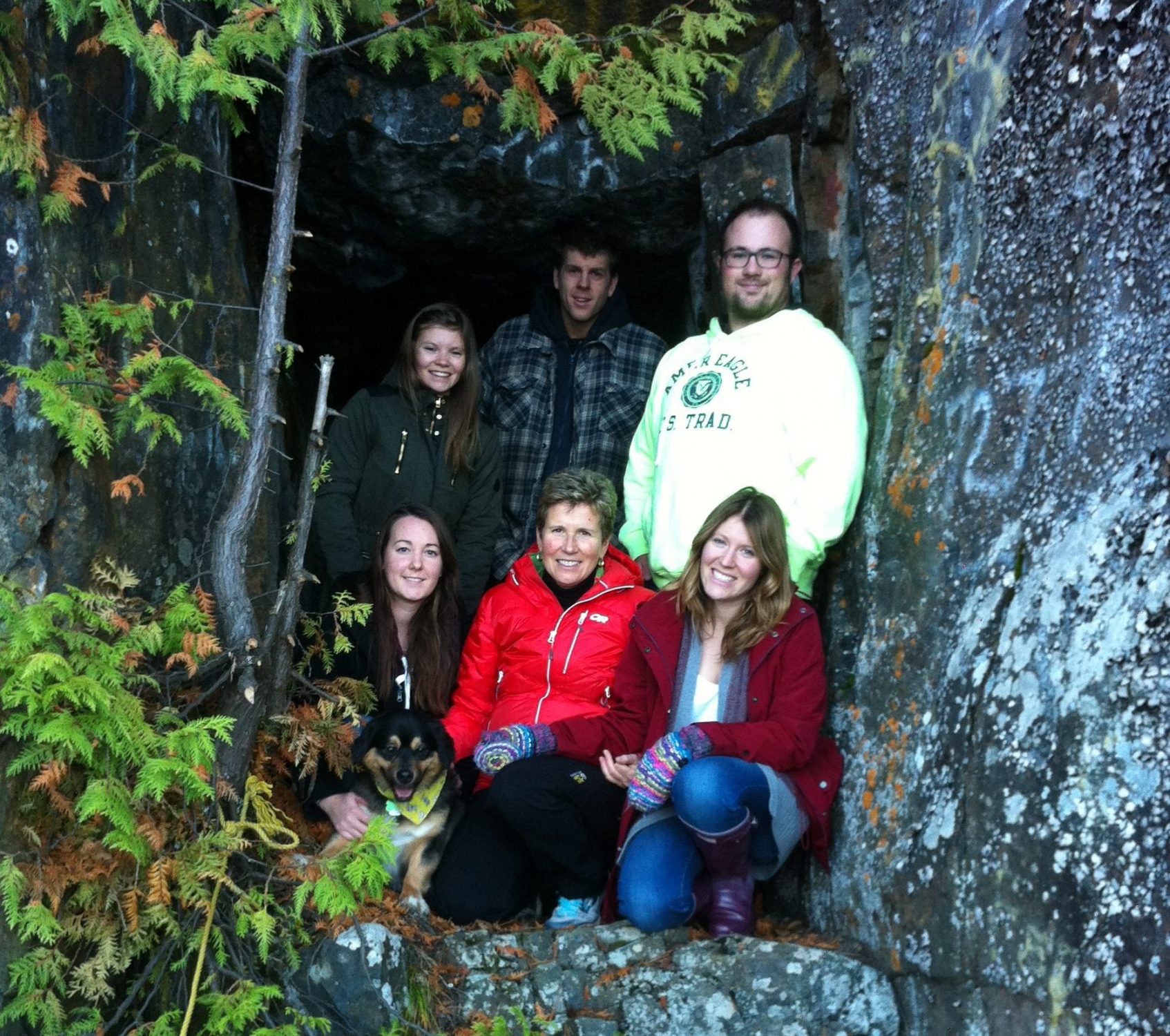
Group standing in front of one of the five mining tunnels at the base of Devil’s Rock
Discover The Tunnels From The Silver Rush Era
Someday if you are at water level just below Devils Rock, you’ll be able to discover the five mining tunnels chiseled during the Cobalt’s famous silver rush era somewhere around 1910. You can actually explore the tunnels and the experience is quite unique. You absolutely need a flashlight if you are going to venture in the tunnels.
A Rock Climbing Destination
Devils Rock is also an interesting climbing destination not yet fully developed. There exists some routes as can be seen from the bolts in place, but most of the climbing seems to fall into the multi-pitch trad climbing category, which for Ontario is a rare thing. Topping out on the Finger of God is an experience as it positions you perched looking out over lake Temiskaming. There are several ascensions mentioned in the manual” “Ontario’s Finest Rock Climbs” by David Smart, which give descriptions and directions but expect to take quite a bit of time to discover the routes. There are a considerable number of climbs mentioned in rockclimbing.com, however these are lacking the information to easily discover the climbs.
Devils Rock Long Weekend Climbing Trip video by Matthew Sapiecha 2013 –you tube
The Common Mistakes When Going To Devils Rock

A group on top of Devil’s Rock
Not Taking Enough Time
Simply take a bit more time. Often we rush up there, take a few photos and rush back. If you are rushing in time, don’t go, plan it for a different time. Slow down! Enjoy the hike, enjoy the view, take photos. Simply relax – the wind blowing, the birds churning, the waves breaking way down at your feet… Bring along a snack or picnic. Enjoy a local food picnic.
Missing The Best View Of Devils Rock
If you want to have the best view of Devils Rock face, you need to travel a few hundred meters to the left (north) of the white cross. Often people take pictures of the lake but are not able to get the view often depicted in the articles.
The Two Accesses To Devils Rock.
First you will want to take highway 567 which is off highway 11-B in North Cobalt. For the Bucke Park access you will need to travel highway 567 approximately 4km. For the second access, the small-unmarked parking lot is another 1.5km further. Here is a Google map to help you find your way.

Hiking to Devil’s Rock
The longer access is a scenic 3km gentle climb from Bucke Park. The parking is at the far end of the park. Trail signage is also better. The hike provides for a better footage and a dryer trail but you will be in a constant light climb. When you arrive on top, you will be at the left end of the cliff. You will want to continue all the way to the right where the white cross is located.
The shortest 1.5km hike is from highway 567 where a small-unmarked parking indicates the start of the trail. The walk is flat but will be rocky in some locations so you need good shoes with a good ankle support. In the spring or fall, sections of the trail will be wet and you might have to detour slightly around the puddles. When you arrive you will be at the right end of the cliff. Always keep your right as you will see a few junction areas.
______________________________________

Great view of Devil’s Rock from Lake Temiskaming
Several articles have been written about Devils Rock. Take a look at what Backroads Bill wrote on Devils Rock and learn about the legend.
Note : The site is not supervised nor secured by fencing so parents will have to keep a close eye on their children. You can safely visit the site and even if you are at a distance from the edge you will still get to appreciate the spectacular views.
___________________________
This Nature and Outdoors blog post has been written in April 2016 by Jocelyn Blais, a volunteer collaborator to the Destination Temiskaming blog, an engineer, an entrepreneur and a nature enthusiast. To learn more about Jocelyn.